| Sign In | Join Free | My chinacomputerparts.com | 
 | 
Brand Name : Hi-Cloud
Model Number : PM-1500 High Precision Airborne LiDAR System
Certification : ISO, others upon the requests
Place of Origin : China
MOQ : 1
Price : Negotiable
Payment Terms : T/T
Supply Ability : 15 sets/month
Delivery Time : 20-30 working days
Packaging Details : Transport Case
Application : Highway survey and design
FoV : 75°
Range Accuracy : 5mm@50m
Max. Range : 1500m
Angular Resolution : 0.001°
Camera Resolution : 42.4MP
5mm@50m high precision 1500m long range 40-400 scans/s speed PM-1500 Airborne LiDAR System for highway survey and design
Highway design needs high-precision data as the basis, while mountainous areas generally have complex terrain and dense vegetation. Using traditional means such as manual survey and aerial photogrammetry not only has complex and difficult operation and long construction period, but also can not obtain high-precision topographic map and digital ground model to meet the design requirements. Airborne LiDAR technology is an advanced technical means to obtain three-dimensional spatial information data. It can better penetrate vegetation to obtain surface information, which has brought a new breakthrough in the way and efficiency of highway survey and design in mountainous areas.
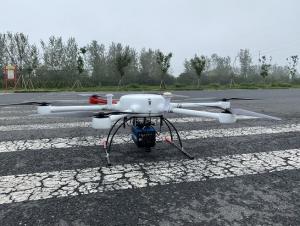
PM-1500 airborne LiDAR system mounted on Fenghu VTOL UAV or L150 multi-rotor UAV can be effectively applied to highway survey and design. Based on the operation planning software equipped with PM-1500 airborne LiDAR system, the data acquisition routes and parameters in the survey area are planned, and the system can carry out intelligent data acquisition. Through point cloud data pre-processing and point cloud classification, it is easy to produce digital products required for highway design such as DTM, DOM and DLG.
Parameters
| Items | Indicators | Parameters | 
| Laser Scanner | Wave Band | Near Infrared (Class 1 ) | 
| PRR | 100-2000kHz | |
| Maximum Measurement Range | 1000m@20% reflectivity | |
| 1500m@60% reflectivity | ||
| Range Accuracy | 5mm@50m | |
| FoV | 75° | |
| Angular Resolution | 0.001° | |
| Scan Speed | 40-400 scans/s | |
| Camera | Camera Resolution | 42.4MP | 
| Focal Length | 28mm | |
| POS System | Position Accuracy(post-processing) | Horizontal 0.01m | 
| Elevation 0.02m | ||
| Orientation Accuracy(post-processing) | Heading 0.009° | |
| Pitch/Roll 0.005° | ||
| System Performance | Dimension | 293×165×164mm | 
| Absolute Accuracy | horizontal <5cm | |
| vertical <5cm | ||
| Weight | 4.4kg | |
| Multi Echo | 4 times | |
| Temperature and Humidity | Operation: -40℃~60℃, Humidity 85% | |
| Storage: -45℃~70℃, Humidity 85% | 
|   | 
| PM-1500 Airborne LiDAR Detection System Aerial Laser Scanning 1500m Range Images | 
 Lightweight 1500m Airborne LiDAR System PM-1500 2000kHz Mobile LiDAR Mapping


                                                            Lightweight 1500m Airborne LiDAR System PM-1500 2000kHz Mobile LiDAR Mapping
                                                    
                        
                     Emergency Airborne UAV LiDAR Mapping LiDAR Scanning System PM-1500 1500m Range


                                                            Emergency Airborne UAV LiDAR Mapping LiDAR Scanning System PM-1500 1500m Range
                                                    
                        
                     1500m Range Airborne Mobile LiDAR System UAV LiDAR Sensor PM-1500


                                                            1500m Range Airborne Mobile LiDAR System UAV LiDAR Sensor PM-1500
                                                    
                        
                     Range 1500m PM-1500 Aerial LiDAR Scanner LiDAR Mapping System For Monitoring


                                                            Range 1500m PM-1500 Aerial LiDAR Scanner LiDAR Mapping System For Monitoring
                                                    
                        
                     2000kHz 1500m Range PM-1500 4.4kg Airborne LiDAR System For Building Change


                                                            2000kHz 1500m Range PM-1500 4.4kg Airborne LiDAR System For Building Change
                                                    
                        
                     100-2000kHz PRR PM-1500 Airborne LiDAR System For Topographic Mapping


                                                            100-2000kHz PRR PM-1500 Airborne LiDAR System For Topographic Mapping
                                                    
                        
                     ARS-200 2.5kg Integrated Airborne LiDAR System 330m Scanning Range


                                                            ARS-200 2.5kg Integrated Airborne LiDAR System 330m Scanning Range
                                                    
                        
                     Long Range 1350m Drone Airborne LiDAR System ARS-1000L High Accuracy


                                                            Long Range 1350m Drone Airborne LiDAR System ARS-1000L High Accuracy
                                                    
                        
                     100-2000Khz PRR PM-1500 Airborne Laser Scanning LiDAR Systems For Drones


                                                            100-2000Khz PRR PM-1500 Airborne Laser Scanning LiDAR Systems For Drones
                                                    
                        
                     1500m Range PM-1500 LiDAR UAV Mobile Mapping System For Forest Resource Survey


                                                            1500m Range PM-1500 LiDAR UAV Mobile Mapping System For Forest Resource Survey